The three-times-a-day bus is meant to drop me off at the Butcher's Arms in Farnborough, but these days that name doesn't attract people: so it's now The Inn at Farnborough. I wonder if they paid a marketing guy lots of money to come up with that name.
Here is a link to today's photos.
Today's walk starts by going down the hill from Farnborough to the A423 junction. This is where I finished yesterday. And then it's back up the hill to Farnborough. Silly, I know. I don't want people to say I cheated. Anyway there's a photo with my rucksack indicating where I hitched from yesterday. And another photo showing the long hill climb back into Farnborough.
This idea of hills is quite knew to me, having spent the last four days just rising by about 6 feet every 3 miles or so. Today I met quite a few of them.
The other thing that is new is that it rained a lot today: agreed it was gentle rain but it did last for several hours.
The final thing that is new is that the rest of my holiday involves map-reading: you don't have to do much of that whilst walking the towpath! I've photocopied the pages of my guide book to the D'Arcy Dalton Way. That was a good idea. By the time I had got through a page of the instructions, the page was soaked through.
The route out of Farnborough is quaint (see photo) and goes passed the gravestones of the church, which my book says is 12th century but largely re-built in the 14th (see photos).
Just outside Farnborough (when it had just started rainly heavishly and I had just put my camera away), I came across this cow and calf. My guess is that the cow had recently been born. But I'm no expert on this. Having decided this, I got my camera out (in the rain); it said it needed new batteries; I changed the batteries over (in the rain); and took a photo (in the rain); cleaned the lens of the raindrops; and took some more photos.
Most of today's walking (and probably the rest of the trip) is across fields (often literally that). On the outskirts of Mollington, I came across several horses (and took some photos).
The approach to Mollington is across this lawn (see photo). Immediately afterwards there were two more horses (more photos). And these horses were next to Mollington Church (see photo). My book says Its fourteenth-century church with a fifteenth-century tower obviously replaced an earlier building as its font dates from the time of the Normans.
After Mollington, the rain really starts. In the seclusion of some trees, I add several layers of clothing (both top and bottom!) which were successful at keeping the rain out.
The route goes over the M40. The right hand side of the second M40 photo shows the route I have just trod; the route goes right to left along the trees at the very top (right) of the photo and then it goes along the edge of the M40 from that line of trees all the way to the bridge. So for the last two-thirds of a mile I've been deafened by the sound of the motorway.
For the next 3 miles there are no photos. I guess that is because of the rain.
The instructions say take path straight on across the next field to a stile in the far hedge, and that meant walking about 1K through this field of corn-on-the-cob (see photos): it was weird as I couldn't see where I was going, certainly couldn't see the stile in the far hedge and I was looking out for any combine harvesters which would be on top of me before I could get out of the way!
The next photo is taken at Bush Hill. This is not far from Edge Hill, the scene of the first major battle of the Civil War in 1642 (according to my book).
The next photo shows the lovely approach to Hornton (and the sun is shining). There are some other photos in Hornton including one of the Dun Cow (which was unfortunately but quite understandably shut). The final photo of Hornton is the one with the sheep.
There then follow a few artistic photos (interspersed by photos of two more horses)!
The final photo is of The Bell Inn at Shenington (and as I arrived at about 4.40pm it was closed). Like the Dun Cow at Hornton, this pub looked inviting.
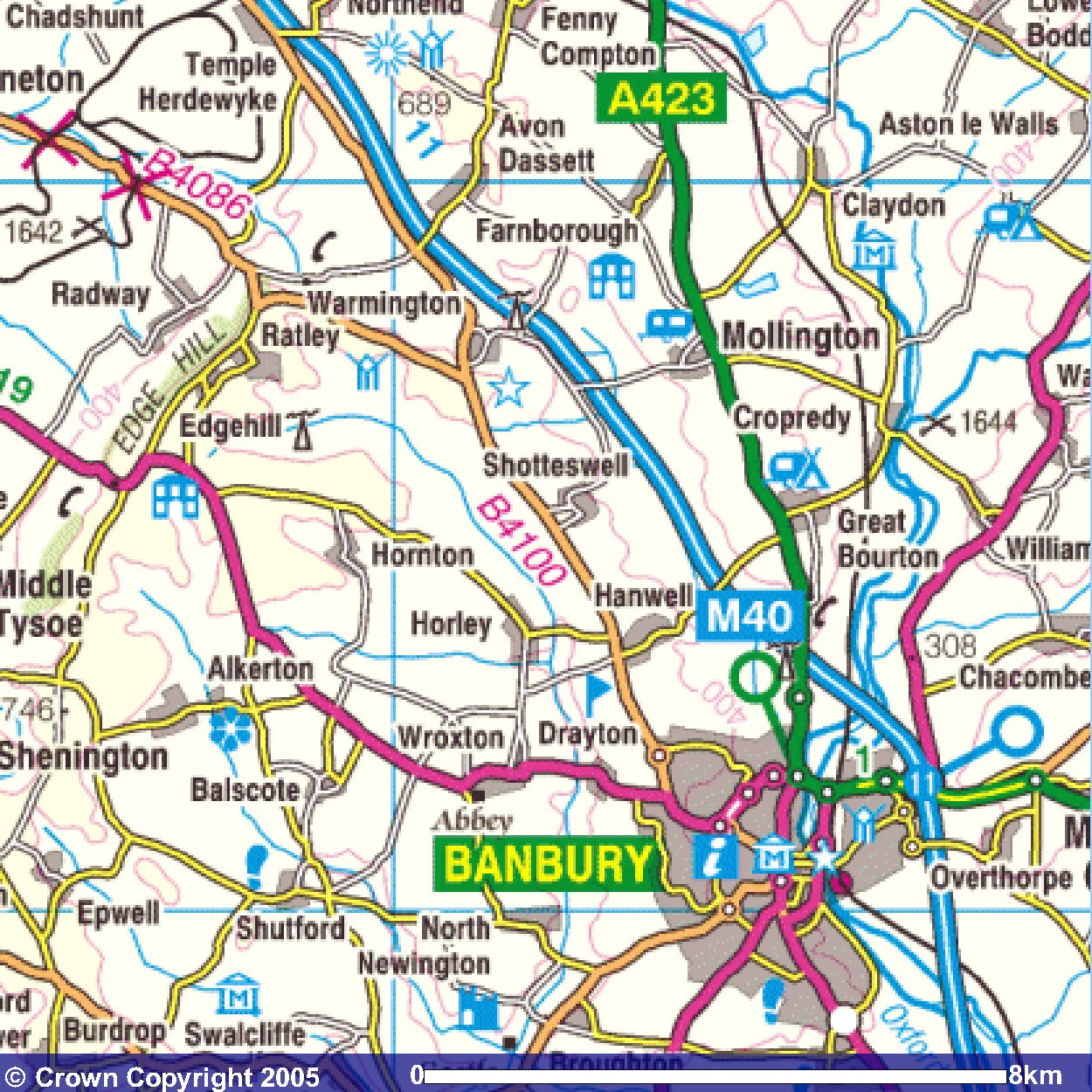
Images produced from the Ordnance Survey Get-a-map service.
Images reproduced with kind permission of Ordnance Survey
and Ordnance Survey of Northern Ireland.